


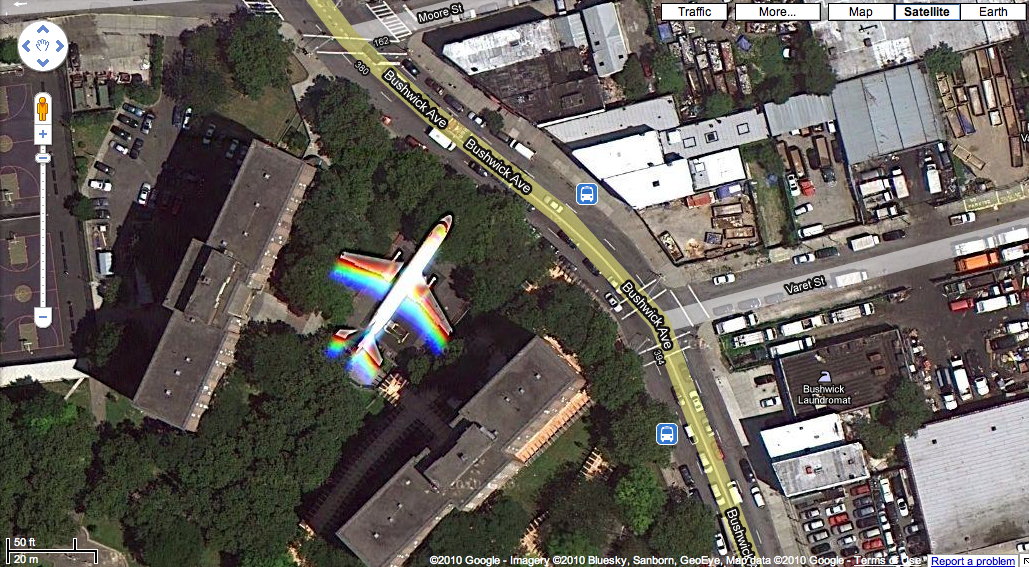
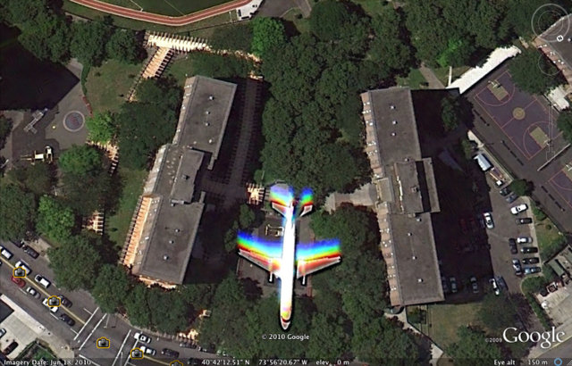
This crazy image comes courtesy of Brooklyn-based photographer, Christoffer Delsinger who discovered an image of an airplane hiding in Bushwick Houses in Google Maps. Click to see for yourself! The official imagery date is June 18th, 2010 and the plane appears in both Google Earth and Google Maps, but not in the street views which are from 2009. Here’s a closer image using Google Earth:
There appear to be wooden pathways leading from the building to the tail of the plane, as well as circling the building. The buildings are part of Bushwick Houses, a 16-acre housing development between Bushwick Avenue, Flushing Avenue, Moore Street and Humboldt Street by the New York City Housing Authority from 1960 and has a great swimming pool open to the public that we’ve frequented on hot summer days. With nearly 3000 residents in 1,221 apartments and eight buildings, whatever was going on June 18th would have been pretty conspicuous to both residents and people walking by on the street. Maybe a film set?
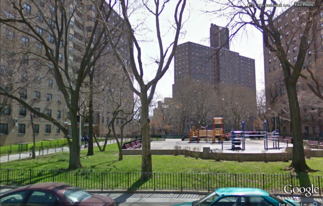
Normally, there is a jungle gym and playground where the plane is, here’s a street view from 2009:
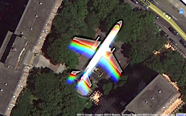
Okay, just kidding. A summer April Fool’s…The images are real but obviously a plane just flying overhead. But check out the pool in Bushwick Houses though, it’s a nice warm weather escape.
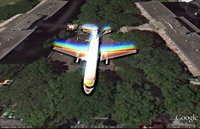
In this extreme Google Earth closeup, you can see that the plane is above the trees and the psychedelic colors are probably just from the plane moving faster than the satellite shutter speed.
For more fun Google Earth images, check out the Untapped exploration of Manhattan, designed as Paris.Next, check out these notable archeological sites in NYC or the Secrets of Grand Central Terminal. Get in touch with the author @untappedmich.